
Have you ever wondered about the difference between an ocean and a sea? Or questioned why Australia is a continent instead of an island? You’re not alone. The Earth is so mind-boggling in its size and scope that it fosters genuine curiosity. From the deepest point in the world to the Earth’s real age, here are 15 geography facts you’ve always wondered about.
How Old Is the Earth? (And How Do We Know Its Age?)

Although there is no way to know the Earth’s exact age, scientists have calculated it to be roughly 4.54 billion years old, give or take 50 million years. But how did they arrive at this number? Although scientists have pondered this question for centuries, more recent technological advances have made it easier for researchers to understand the Earth’s age. Above all else, radiometric dating has been the most helpful in figuring out the Earth’s birthday because it allows scientists to pinpoint the age of rocks. The oldest rocks on Earth — 4.03 billion years old — were found in Canada, while Greenland, Australia, and Swaziland are home to rocks that range from 3.4 to 3.8 billion years. To top that, scientists have discovered stardust that’s a staggering 7 billion years old, which means the Earth is relatively young in comparison to the rest of the universe.
What Does the Prime Meridian Denote?
A meridian is an imaginary line that runs from north to south on a map. With 360 meridians around the globe, the prime meridian is the starting point for measuring all other meridians. At a longitude of 0 degrees, it also denotes the separation between the Eastern and Western Hemispheres — with 180 meridians to the east and 180 meridians to the west. The implementation of the prime meridian in Greenwich, England, in 1884 unified the globe in its time and space measurements, resulting in all maps being drawn according to the prime meridian’s longitudinal location.
What Is the Tropic of Cancer?

The Tropic of Cancer is a latitudinal line, also known as a parallel, that runs from east to west around the globe. In addition to the equator, it is one of the five major parallels on Earth (the other three being the tropic of Capricorn, the Arctic Circle, and the Antarctic Circle). Located 23.5 degrees north of the equator, the Tropic of Cancer plays an important role in the sun’s geographical relationship to the Earth. It denotes the northernmost point on Earth where the sun is directly overhead at high noon, which happens annually on the summer solstice (for the Northern Hemisphere) in June. After reaching this point, the sun’s rays travel south until they reach the same angle at the Tropic of Capricorn in the Southern Hemisphere, which happens in December on the winter solstice.
Why Is the International Date Line Where It Is?
After the world was divided into time zones, the International Date Late (IDL) became one of the most important meridians on Earth. Located halfway around the globe from the Prime Meridian, the IDL approximately follows the 180-degree meridian, with a few zig-zags here and there. Despite its significance, the IDL’s location was chosen arbitrarily, as it can be found in a section of the globe that is almost entirely ocean. In a sense, the International Date Line also makes time travel real — when you cross it, travelers will either add or subtract 24 hours from their day. However, since the International Date Line has no legal status, countries are free to choose which side they are on, which accounts for the IDL’s disjointed course.
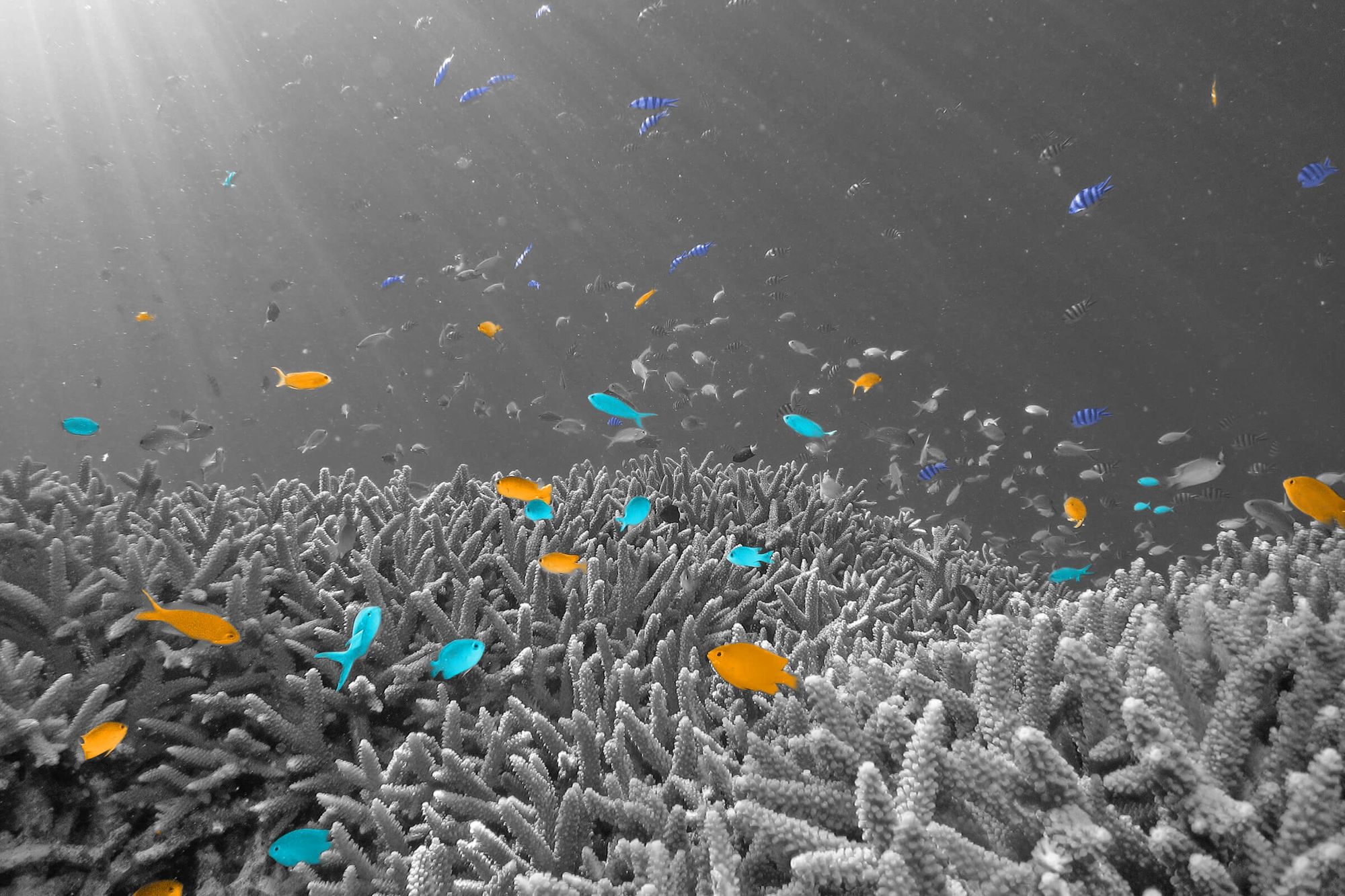
What Is the Difference Between an Ocean and a Sea?

In everyday vernacular, the words “ocean” and “sea” are often used interchangeably. But in geographical terms, the two are quite distinct. While oceans are referred to as the large bodies of water that take up much of the globe, seas are much smaller entities, a term geographers use to describe the location where the land meets the ocean. For example, the Bering Sea is part of the Pacific Ocean, but since it is located between the landmasses of Alaska and Russia, it is classified as a sea.
What Is the Deepest Point in the Ocean?
Located in the Mariana Trench southwest of Guam, the Challenger Deep — named for the first crew to record its depth — measures an astounding 36,200 feet deep, which is three times deeper than the average depth of the ocean floor. Using a sounding rope, the HMS Challenger calculated the trench’s depth to be 26,850 feet in 1875. As more teams flocked to the western Pacific over the years, researchers used advanced sonar techniques to measure the current recorded depth. To this day, the Challenger Deep is the deepest known point on Earth. But with an astounding percentage of the ocean yet to be explored, we never know what other fathomless depths will be discovered in the future.
Is a Marsh the Same as a Swamp?

While they may appear similar, marshes and swamps are technically quite different. Although they both are a type of wetland, a swamp can also be compared to a lowland forest, as it is classified based on the type of tree that grows in its ecosystem. For example, depending on the predominant tree, a swamp can be classified as a hardwood swamp, a cedar swamp, or a cypress swamp (like South Florida’s Big Cypress Swamp). On the other hand, a marsh has no trees and instead is dominated by plants and grasses that thrive on the waterlogged soil. Although many people believe the Everglades to be a swamp, it is actually the largest marsh system in the U.S. — before it was partially developed, it took up an astonishing 4,000 square miles of the Florida landscape.
What Is (Actually) the Tallest Mountain on Earth?
Most people already know that Mount Everest, with a peak that sits 29,035 feet above sea level, soars above any other mountain on the planet. However, if we’re talking about mountains that exist below sea level, then Hawaii’s Mauna Kea blows Mount Everest out of the water, so to speak. At 32,696 feet from base to summit, Mauna Kea is approximately 3,661 feet taller than Everest. The reason Mauna Kea doesn’t receive more recognition for its size? Most of the mountain exists underwater, with only 13,796 feet rising above sea level.
What Is a Geyser? (And Is It the Same as a Volcano?)

A geyser is a hot spring that erupts water and steam, due to pressure that is created underground. Formed as a water-filled tube that connects the atmosphere to the Earth’s crust, a geyser erupts when magma heats the water, forcing it upward towards the Earth’s surface. Although a geyser is not the same as a volcano, they are somewhat related, as a geyser manifests the same sort of activity, with eruptions fueled by magma. However, unlike a volcano, it is easier to predict when a geyser will blow, as it produces notable seismic activity prior to an eruption. As a result, some researchers study geysers to help them understand more information about volcanoes. There are also certain geysers that blow in a timely manner, like the aptly named Old Faithful — a Yellowstone National Park attraction that erupts roughly 20 times a day.
How Is a Cay Different Than a Key?
If you’re curious as to the geographical distinction between Key West in Southern Florida and Ambergris Cay in Turks and Caicos, here’s the short answer: There is no difference. The geographical terms cay and key are a little bit like “tomato, to-mah-to” — the use of the term depends on where you are. Both are derived from the Spanish word cayo, which translates to “key,” and they’re used interchangeably to describe a low-lying island, sandbar, or coral reef. As a tropical destination with over 60 islands and keys, the British Virgin Islands is also home to a “Key Cay,” making it the only place in the world where both terms are used to describe a single place.
Which River Is Bigger — the Amazon or the Nile?

Measuring 4,130 miles in length, the Nile River in Africa is often considered to be the longest river in the world, while the Amazon River in South America comes in at a close second. Although past data has shown that the Amazon River is anywhere between 3,980 and 4,000 miles in length, a 2007 expedition claimed the length of the Amazon to be an astonishing 4,225 miles. However, since this measurement has not been internationally recognized, the debate over the longest river in the world continues. As a result, many recognize the Nile as the longest river, but give Amazon the title of the largest river by volume.
Why Is Australia a Continent and Not an Island?
Australia is Earth’s smallest continent — closer in size to Greenland than any other continent. So why did geographers decide Australia was a continent instead of an island like Greenland? For starters, Australia has a much larger landmass than Greenland: roughly 3 million square miles compared to Greenland’s 836,000 square miles. It also sits on a tectonic plate, which is partially shared with Asia, while Greenland is on the same tectonic plate as all of North America. Also, much of Australia’s plant and animal life is endemic to the country, including its Indigenous people. The Aboriginal people of Australia are found nowhere else in the world, while the Indigenous people of Greenland, the Inuit, live on different continents in the Arctic. Altogether, these facts led geographers to classify Australia as a continent, although it is technically an island as well.
Where Does One Ocean End and Another Begin?

Despite being divided into sub-oceans, there is only one ocean in the world, which scientists refer to as the “world ocean.” Historically, cartographers and government officials found it helpful to divide the massive ocean into smaller entities, which is how the Atlantic, Pacific, Arctic, and Indian Oceans were named. More recently, the ocean surrounding Antarctica, dubbed the Southern Ocean, has been added to the list. Despite being located in different regions, there is actually no way to tell when one ocean ends and the other begins — because the ocean is a singular continuous body of water. However, there is one exception to this rule. The Southern Ocean is radically different from the rest, with a strong current that surrounds it and notably frigid water, making it easier to recognize where this sub-ocean begins.
How Do Hills Become Mountains?
To learn how a hill becomes a mountain, one must first understand the difference between the two. According to the U.S. Geological Survey, there is no official distinction between a hill and a mountain, since they are both classified as naturally forming landforms that occur as a result of geological activity. However, traditionally a hill is not considered to be a mountain if the summit is under 1,000 feet. For a hill to eventually become tall enough to be generally classified as a mountain, it must be located on shifting fault lines that cause an increase in size. For example, the Himalayas once used to be small hills that grew — over millions of years — into the tallest mountain range on Earth, thanks to ongoing collisions between two large tectonic plates. Conversely, mountains can become hills after millions of years of erosion cause them to shrink.
What (and Where) Is an Esker?

Composed of gravel, sand, and silt, eskers are formed after a glacier stops flowing, resulting in long, narrow ridgelines that appear snake-like from the sky. Sweden is home to one of the longest eskers in the world, which stretches for 155 miles and passes through the city of Uppsala. In the state of Maine, eskers often resemble a long, skinny peninsula that divides lakes and bogs, which is why eskers were traditionally used as trade routes for early settlers. Eskers also can also play an important role in road construction. In rugged destinations like Canada and Alaska, builders have used the landform in order to lower construction costs — for example, part of the Denali Highway was built on top of an esker.