
The many borders that criss-cross our world often neatly separate the planet into countries, states, territories, counties, cities, and towns. But sometimes, thanks to a variety of historical and geographic factors, the world’s borders aren’t so clear-cut. Here are 10 surprising and often bizarre borders around the world you may not have heard about — from ones that run straight through towns and businesses to an island that changes hands every six months.
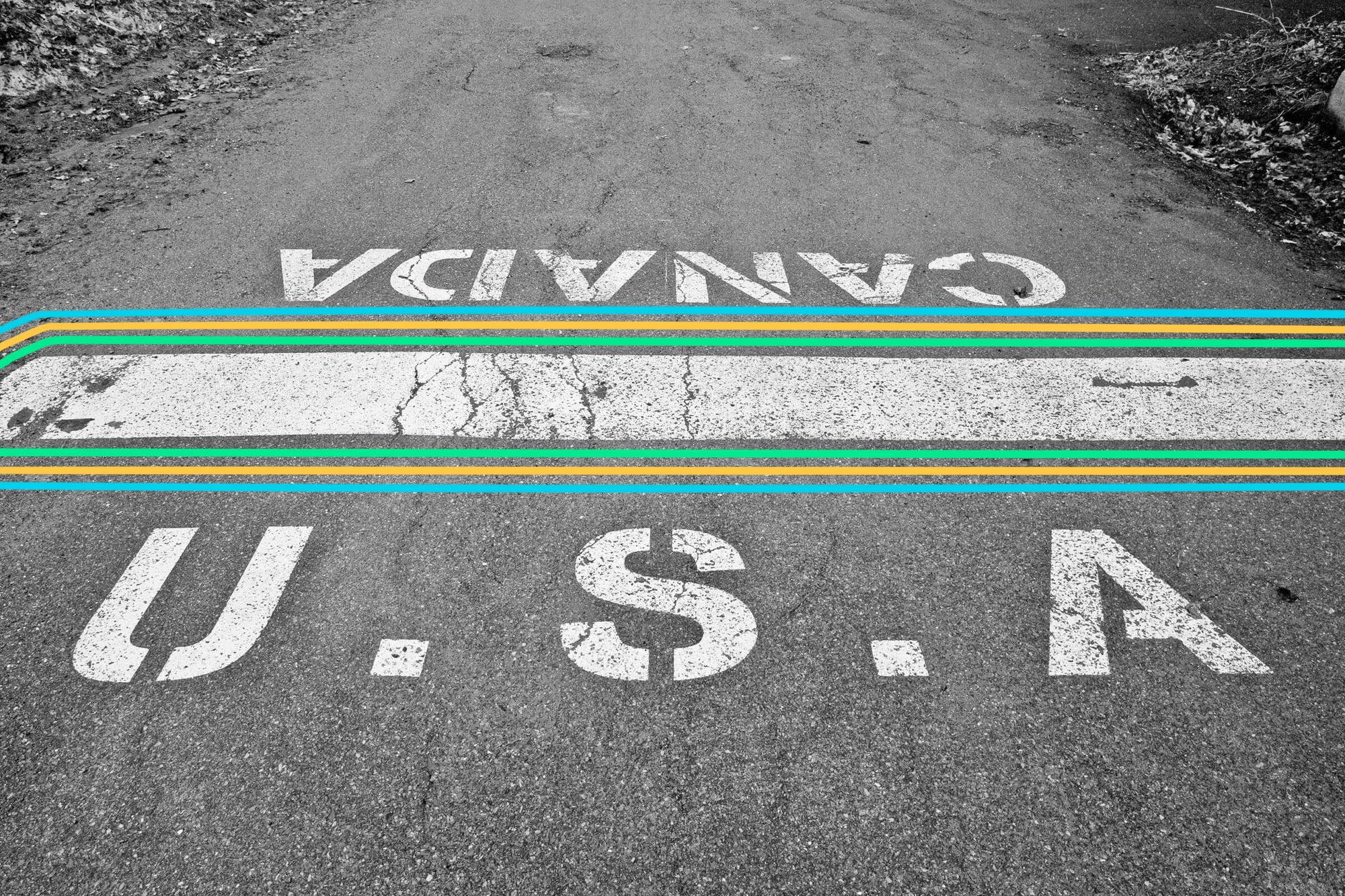
In Derby Line, Vermont, the U.S.-Canada Border Runs Right Through Town
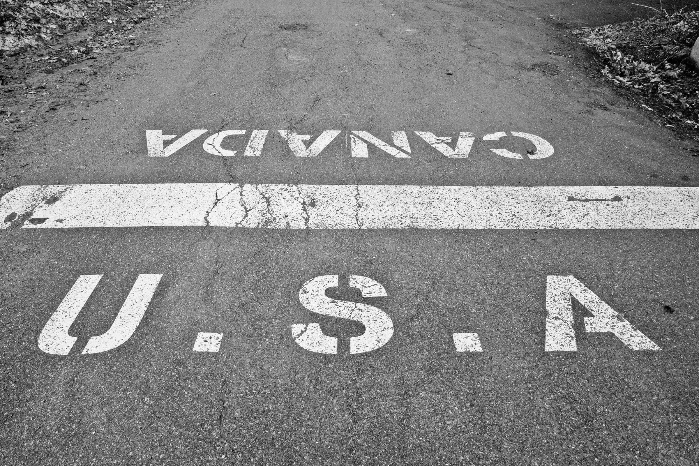
On one side of the street, you’re in Derby Line, Vermont. On the other side, you’re in Stanstead, Quebec. The border between the U.S. and Canada goes right through these two towns (which basically function as one), through businesses and along a main street named Canusa Avenue. In one area, the border is even made up of flower pots. No one knows exactly why the border was sent straight through town in the early 1700s (some attribute it to a simple mapmaking error), but Derby Line-Stanstead has chosen to embrace it. The curling hall is in both countries, and so is the library. There is a customs house and border patrol, however, so if you’re out crossing the road, you’ll need to show a passport.
The Neum Corridor in Bosnia Cuts Through Croatia

Though it may appear on a map that Bosnia is landlocked, a closer look reveals that the country has a narrow strip of land that extends through Croatia and gives the country just 12 miles of shoreline on the Adriatic Sea. Called the Neum Corridor, the border dates to the 1699 Treaty of Karlowitz, which gave a substantial amount of land around the Croatian city of Dubrovnik to Venice, Italy. Dubrovnik was worried about being so close to Venice and the potential for invasion, so they gave away some of their land to the Ottomans as a buffer — and since Bosnia and Herzegovina were Ottoman-ruled provinces, that’s where the Neum Corridor is today. Aside from Monaco, Bosnia has the shortest coastline of any other country thanks to this stretch of land.
The France-Switzerland Border Goes Through a Hotel
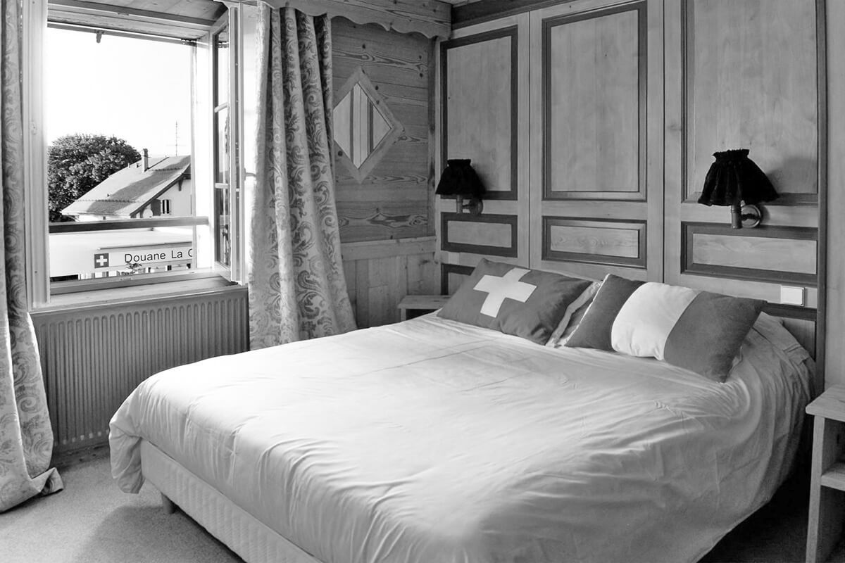
Guests at the Hotel L'Arbézie Franco-Suisse have the unique opportunity to sleep in two countries at once. The hotel sits right on the border between France and Switzerland in the alpine village of La Cure, 15 miles northwest of Lake Geneva. It was built between 1862 and 1863, when Napoleon III redrew the border between the two countries — right through the land owned by a French citizen named Ponthus Arbez, who decided to build a house on the border before it became official. At first, the French side had a bar and the Swiss side had a store, but when Arbez died, his sons converted the property into a hotel in 1921. Today, guests can cross between the international border in the hotel’s dining room, and some rooms even allow them to sleep with their heads in France and their feet in Switzerland.
Belgium and the Netherlands Have Borders Within Borders

The border between Baarle-Nassau, a town in the southern Netherlands, and Baarle-Hertog, Belgium, is one of the most complicated borders in the world. The border zigzags through the Dutch town and creates a series of Belgian enclaves — parcels of land that belong to Belgium but are completely surrounded by the Netherlands. However, some of those Belgian enclaves themselves contain Dutch enclaves, like a border-based version of Inception. The border goes through homes, businesses, parks, and probably even a couch or two. It’s marked along the ground with a series of white crosses. The peculiar arrangement was a result of medieval land treaties and swaps, when landlines were determined by the aristocrats that lived there.
The Highest Border in the World Is Atop Mount Everest

Mount Everest is the world’s tallest mountain, and since it straddles the border between China and Nepal, it’s also home to the world’s highest border. The border goes right through the summit, and climbers can scale the mountain from both sides. And in 2020, the world’s most elevated border got even higher. China and Nepal separately took new measurements of the summit and then jointly announced that Mount Everest was even taller than they had originally thought. Now, Mount Everest’s apex is officially 29,032 feet — just about three feet taller than before.
Northwest Angle, Minnesota, Is Surrounded by Canada, a Lake, and a Video Phone Booth

If you want to visit Northwest Angle in Minnesota, you either have to travel through Canada or take a boat or float plane to get there. The small community of about 120 people is the only part of the contiguous United States that extends north of the 49th parallel. The Angle, as it’s known by locals, borders the Canadian provinces of Manitoba and Ontario and is separated from the rest of Minnesota by the Lake of the Woods. Northwest Angle is the result of a mapmaking error, when early explorers misattributed the source of the Mississippi River. Since the area is so remote, if you want to use the land border to cross into Canada and continue back into Northwest Angle, Minnesota, you have to go into a booth to place a video call to Canadian or American customs officers to pass through.
A Tiny Island Changes Hands Between France and Spain Every Six Months
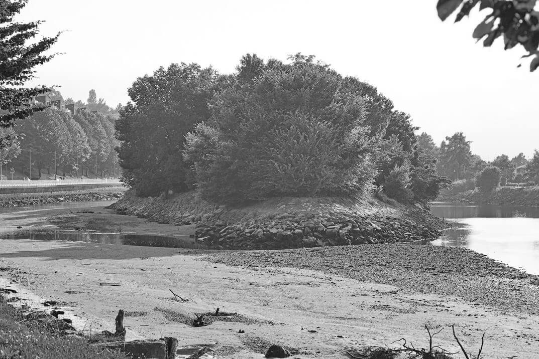
The border of Pheasant Island, located in the Bidasoa River between southwestern France and northeastern Spain, has changed more than 700 times. There are no permanent residents on the two-acre island and visitors are banned — except for twice a year, when government representatives from each country come together on the island to transfer ownership. The island is considered to be a symbol of peace and neutrality. After the Thirty Years War ended in 1648, France and Spain signed the Treaty of the Pyrenees on the island and made sure it would alternate ownership in perpetuity to demonstrate equality between the two nations. Pheasant Island is what’s known as a condominium, a territory belonging to two separate nations at the same time.
Bir Tawil Has No Borders of Its Own

With no permanent residents and no one looking to claim it, Bir Tawil is a true no-man’s land — one of the last unclaimed areas on Earth. The trapezoid-shaped, almost entirely barren land is located north of Sudan and south of Egypt. But neither Egypt nor Sudan want to claim the land as their own because of a border technicality. Neighboring Hala'ib is much more valuable land to both countries because it abuts the Red Sea, but when British colonists drew border lines, the agreement stipulated that each country can only have one of the territories and not both. If they claim Bir Tawil, they'll lose lucrative Hala'ib, which is still disputed between Egypt and Sudan.
The Island of Tasmania Actually Has One Land Border

Tasmania is a 26,000-square-mile island located about 150 miles south of mainland Australia. The island makes up one of Australia’s six states and territories, but it shares a small border with another Australian state: Victoria. Located on a small island called Boundary Islet, the border is only 279 feet long and was created by accident. Back in 1825 when the Tasmania-Victoria border was drawn in Australia, no one noticed the tiny island, so the border ended up running right through it. Boundary Islet has no human residents — just New Zealand fur seals and crested terns.
The Kingdom of Talossa’s Borders Are in Milwaukee, Wisconsin

It’s not an internationally recognized border, but it’s a border nonetheless: The Kingdom of Talossa is a sovereign microstate (at least to its citizens) that sits right in downtown Milwaukee, bordered by Lake Michigan on its eastern side. Talossa has its own language, its own government, its own flag, and its own discussion forums for anybody who wants to become a citizen. The micronation was founded in 1979 when a 14-year-old boy named Robert Ben Madison who was confined to his room decided to secede from the United States and create a constitutional monarchy. Although it wasn’t taken seriously at first, by the time the internet rolled around, the Kingdom of Talossa went viral and captured the imagination of many others, who joined in as citizens.